
Trace an Auburn Street Directory
Start the Auburn street directory trail with a present-day street number and the municipal parcel, rather than a name alone. Cayuga County Tax Map Online can connect a location to its tax-map number, owner field, municipality, deed reference, zoning, assessed values, and latest-modified field. Those fields identify a property record. They do not confirm a current household. Keep the location and the tax-map number together before moving to any other source.
- Use the GIS Location search with the street number and name. Select the parcel after reviewing any geocoder result, then record its municipality, tax-map number, location, owner field, deed reference, and access date.
- Check the same parcel through Cayuga County Real Property Services and PROS for assessment and tax-map context. Treat an owner or mailing address as a property clue, not an occupancy claim.
- Run the deed reference, current owner, or party name in the Cayuga County Clerk SearchIQS index. Match the legal description and book or page before treating two entries as the same property.
- For a registered voter checking an individual record, use the state lookup with the required county, name, date of birth, and ZIP. It has no documented Auburn street-wide roster.
- For an older household, compare the directory year, street section, house number, and original street name at Seymour Library or through the County Historian. The historical entry remains a dated observation.
This sequence moves from address to parcel, owner field, deed chain, and directory evidence without treating any one record as a complete list of people. A current parcel can have a different mailing address, a vacant building, several units, or an owner who does not live there.
Auburn Street Directory Search Fields
Exact entry format matters when an Auburn street directory search begins in the parcel viewer. The county guide distinguishes a parcel result from an Esri geocoder point. It also warns against entering only a street name or the phrase “off Main.” A full location and the field formats below make it easier to recover the parcel that supports the rest of the address trail.
| GIS or tax-map field | Entry type | Format or use | Result limit |
|---|---|---|---|
| Tax Map Number | Search/autocomplete | Section-block-lot, such as 115.60-1-38.1 | Select the parcel result |
| Owner | Search/autocomplete | Last, First; multiple owners separated by a semicolon | Broad partial searches can overwhelm results |
| Location | Search/autocomplete | Street number plus name, such as 123 Main | Do not use only the street name |
| Deed Reference | Search/autocomplete | Book-page, such as 1234-123 | Recent deeds can lag and some parcels lack a reference |
| PROS map fields | Map search | Municipality, Section, and Sub-Section; map sections use three digits with leading zeroes | Quick-search filters were not exposed in the inspected text |
GIS provides up to ten suggestions and up to one hundred results. The map can be printed or measured, and adjacent parcels are opened by clicking them after a street location is found. The guide does not document a radius, neighbor, or unlimited street export. That limit matters when a street has many parcels.
Note: A geocoder point is only a starting location until the nearby parcel is selected and its own popup is reviewed.
Auburn Street Records by Address
Several Auburn records can be keyed to an address, but their coverage is not interchangeable. Parcel and deed tools establish land and recorded transactions. A city request can seek an address-specific permit or certificate trail. Historical street listings add a dated compiler’s entry. The coverage below keeps each record attached to the question it can actually answer.
| Address-keyed record | Custodian or service | Useful return | Access route and boundary |
|---|---|---|---|
| Parcel and tax map | Cayuga GIS, PROS, Real Property Services | Tax-map number, municipality, location, owners, values, zoning, deed reference | Public web and office route; owner, mailing, and situs fields do not prove occupancy |
| Recorded deed or map | Cayuga County Clerk and SearchIQS | Grantor, grantee, recording date, book or page, legal description | Free index; images may require payment, subscription, or office access |
| Code or permit file | Auburn Code Enforcement | Address-specific permit, complaint, work, inspection, or certificate context where released | Written request with tax-map number and date range; no public searchable index was located |
| Historical street listing | Seymour Library, County Historian, digital directory collections | Dated occupant, boarder, business, or property-owner entry | Directory year and original spelling are essential; it is not a current record |
| Voter Lookup | New York State | Individual registered-voter result when required identity fields match | Individual query only, with protected data withheld and no street-wide mode documented |
The County Clerk keeps the official recording trail, while Real Property Services keeps assessment and tax materials. If a site result is incomplete, call the Clerk at 315-253-1271 or the records center at 315-253-1037 to confirm current access and whether an older book is on-site. Real Property Services can confirm the current request route at 315-253-1270.
Auburn Street Permit Files
Auburn Code Enforcement can hold the address-specific permit, complaint, planning, zoning, and certificate trail that a parcel map cannot show. No searchable public city permit index was located in the reviewed official sources. That is a reason to make a defined request, not a reason to infer that no file exists. Include the full street address, tax-map number, record type, date range, and preferred delivery format.
The Code Enforcement Office provides the current forms and contact route. Its public page also carries a phishing warning for planning, zoning, and code-enforcement applications. Verify a payment or application message through the official city domain and known telephone number before sending records or funds.
Auburn Street Directory Deed Chain
A deed chain gives the Auburn street directory its strongest ownership evidence. SearchIQS reports real-estate images from 1972 forward. Earlier Cayuga books and indexes remain important, including County Deeds beginning in 1816, grantor and grantee indexing from 1889, and County Historian deed indexes that begin in 1794. A result can identify a party to a recorded transaction, but it is not a title opinion and it does not establish who occupies the address.
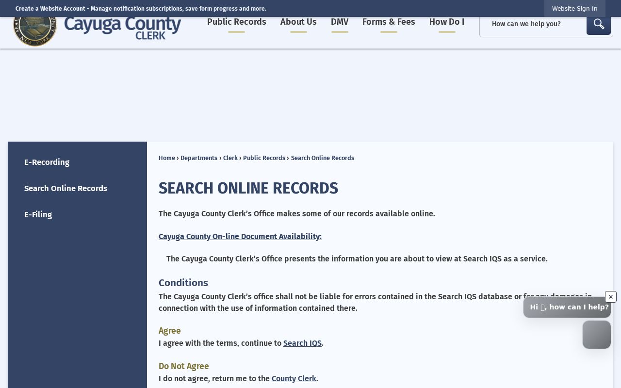
The County Clerk’s Search Online Records information explains that the public index and image access differ by record. The captured service screen is useful because it shows the distinction between free searching and document-image access.
Use an index hit to capture document type, recording date, parties, book or page, and legal description. Then compare the parcel’s deed reference with the returned document before moving backward to the prior grantor. An older non-imaged volume can be requested by its book and page from the Clerk or County Historian rather than guessed from a similar name.
For an office or records-center request, give the document category, party names, recording date if known, book or page, and the parcel’s legal description. Ask whether the requested copy is plain or certified and whether the older volume is held off-site. The Clerk’s current closure notice makes a phone check especially useful before a visit, drop-off, or mailed request.
Auburn Street Directory Index Coverage
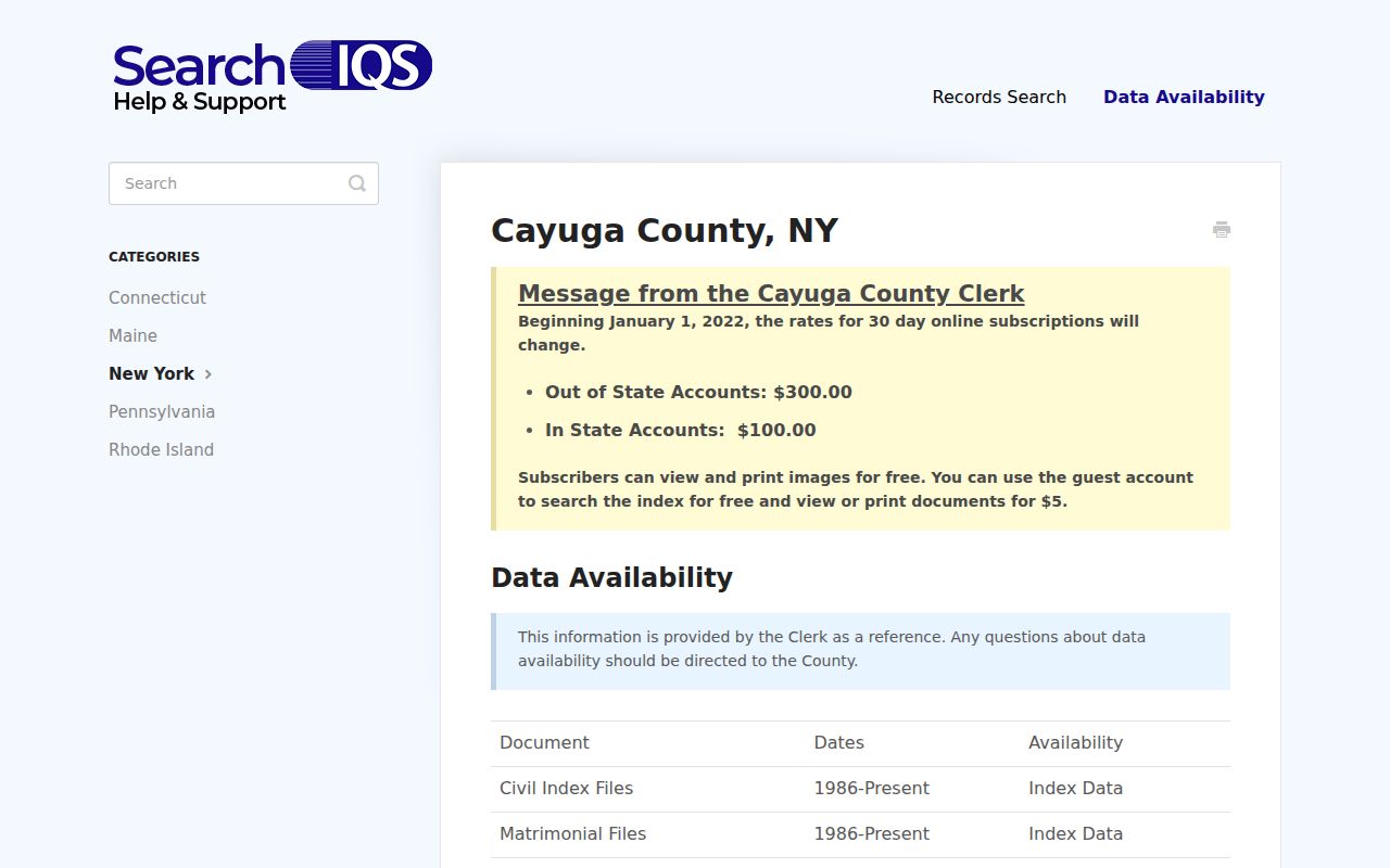
SearchIQS is a bridge between modern deed images and the County Clerk’s deeper historical books. The service’s Cayuga coverage information separates records by category and date span, so a missing image should be read as an access question, not a negative finding. Search the same parcel through a party name, book-page reference, and legal description where the index allows, then preserve the result’s date and record category.
The SearchIQS Cayuga County coverage guide identifies the service’s record-category distinctions. It helps decide whether to continue online, request a document image, or use an historical index at the office.
When the trail moves outside the available web image range, the named record series is the useful request detail. The Clerk’s historical inventory, the records center, and the County Historian are separate channels. Historian research requests use the office’s own form, fee, and turnaround terms, so confirm those current details before sending a request.
Auburn Street Directory Name Changes
Historical street work in Auburn needs a date attached to the address. The common council ordered street renumbering in 1880 for the letter-carrier system. Mechanic Street became Osborne Street in spring 1910. A directory entry can therefore use a number or name that will not return a modern GIS match. Save the original form first, then test the later name or number as a separate crosswalk step.
HistoryForge building entries can preserve current and historical address fields, building type, construction or demolition years, notes, and coordinates. The June 1886 Library of Congress Sanborn set adds building footprints and use. Neither source identifies today’s resident. Pair either map layer with a directory, deed, or city record according to the historical question.
- Parcel
- A mapped unit of land used by the tax system, usually identified by a tax-map number.
- Situs address
- The physical property location used by GIS, tax-map, and code-enforcement records. It can differ from the owner’s mailing address.
- Plat
- A recorded subdivision or survey map showing lots, blocks, streets, or easements. Cayuga maps may need a Clerk book or index search.
- Criss-cross directory
- A reverse-style historical directory arranged by street and house number, useful for a dated address-first search.
For a historical entry, the 1910 directory’s street section runs from pages 517 through 628, while its property-owner section runs from pages 631 through 670. That distinction can keep an occupant entry and an owner entry from being merged into one claim.
Auburn Street Listings in 1910
The 1910 Auburn directory separates resident entries, street listings, businesses, and property-owner material. Its street section is the practical historical counterpart to a modern address search, especially after an original street name and house number have been confirmed. Abbreviations such as h, res, and bds describe how the compiler presented an address. They should not be turned into a modern ownership or household claim.
Seymour Library maintains an Auburn directory run described as 1857 to present, with digital examples and library research channels. For a historical shelf search, preserve the directory year, street spelling, house number, and every abbreviation. The Auburn city directory collection is the fuller route for reading those editions, publishers, and entry conventions.
This local history layer can also explain why a visible parcel differs from an older street entry. Auburn’s later urban renewal changed parts of the built environment, and a demolished structure can still appear in a directory or map. The record proves its own dated observation, not a present condition.
Auburn Street Directory Fallbacks
When the web tools stop short, the request should stay address-specific. For assessment or transfer material, give Real Property Services the address and tax-map number, ask whether a split, merge, or recent transfer is pending, and identify the date needed. For a code file, request the address, tax-map number, record type, and a date range. A defined request is more useful than a broad search for everyone on a street.
The County Clerk offers online, phone, mail, drop-off, and in-person channels, but its office-building closure notice can change the current delivery or counter instructions. Check the Cayuga County Clerk page before visiting or mailing a request. The County Historian, at 315-253-1300, is a distinct historical route for directory, newspaper, architectural, family, church, and deed-index context.
New York’s Freedom of Information Law can support a focused request for a public municipal record. It does not replace eligibility rules for confidential vital records, sealed material, or restricted personal identifiers. Describe the record, address, date span, and preferred format so the custodian can route it.
Note: Confirm the Clerk’s current delivery instructions because the county’s operational closure notice can change physical-access details.
Limits of an Auburn Street Directory
An Auburn street directory cannot show a complete current household. The public parcel roll does not list every unrecorded occupant or household member. DMV-derived address information is restricted, utility customer lists are not public, and an individual voter lookup is not a street-wide list. A postal delivery result also proves only delivery formatting. Protected voters, Address Confidentiality Program participants, sealed matters, and restricted vital records have additional limits.
Keep separate notes for parcel owner, tax mailing address, situs address, recorded party, historical directory entry, and verified delivery line. That simple separation is the best guard against a street search turning a partial record into an unsupported claim about a person.